

Beneath the Waves: 5 Hidden Geological Dangers on the Scotian Shelf
Laying a subsea pipeline requires navigating a complex world of ancient landscapes and active hazards that remain invisible from the surface.

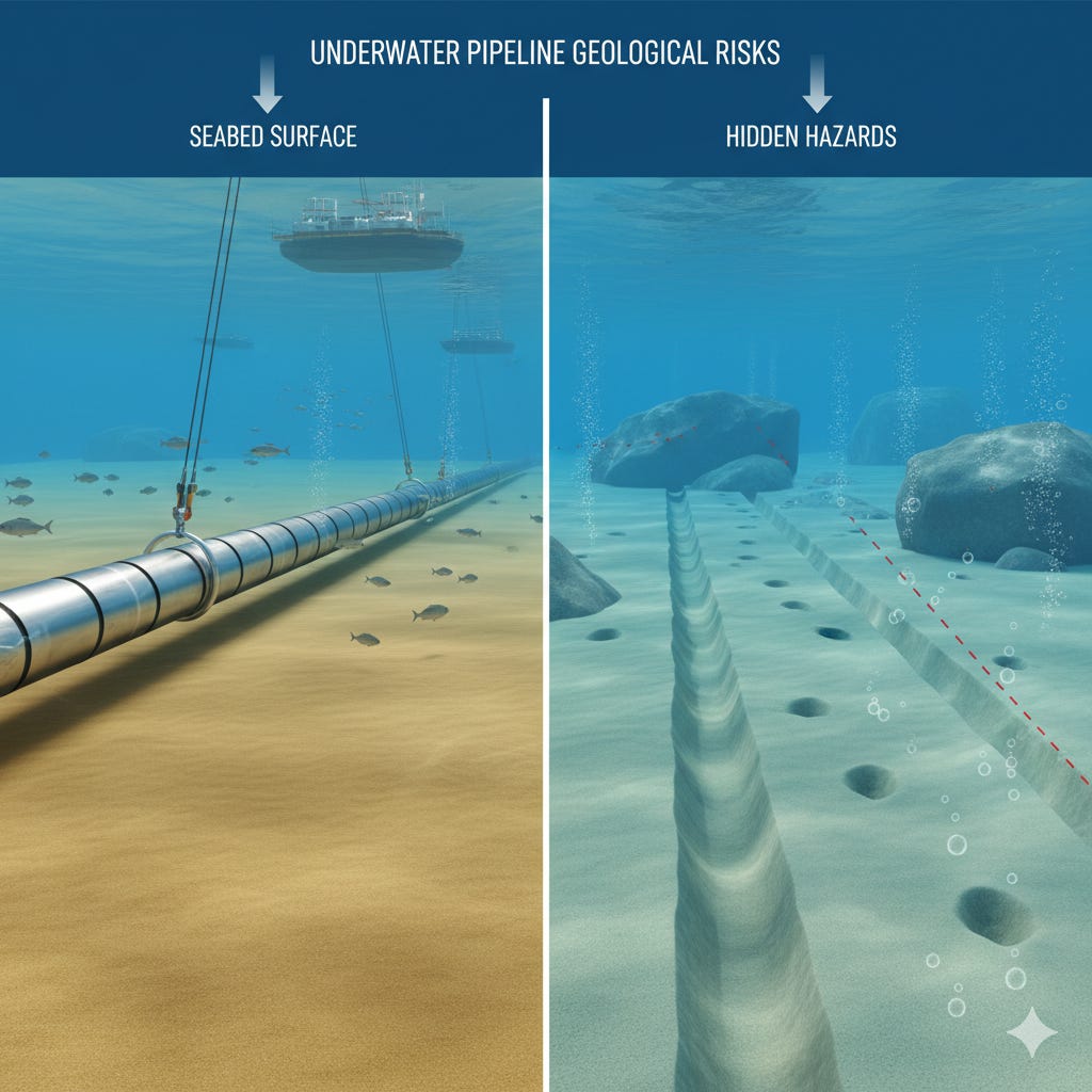
The seafloor is more than just sand and mud. It is a dynamic environment shaped by massive geological forces over thousands of years. Before any underwater construction, like the proposed Blue Atlantic Pipeline, can begin, engineers must understand this hidden world. A detailed study of the Scotian Shelf reveals a landscape filled with relict features from the last ice age and modern hazards that pose significant challenges.
This assessment is a desk-top study of seabed characteristics within the proposed pipeline corridors. It interprets, defines, and maps areas of potential constraints. Understanding these features is the first step in navigating the complex terrain that lies beneath the ocean. Here are five of the most significant geological conditions that must be addressed.
The Seafloor Vents Gas Through Pockmarks
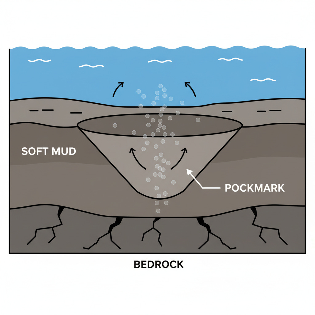
In the deep, muddy basins of the Scotian Shelf, the seabed is dotted with thousands of cone-shaped depressions called pockmarks. These features form when gas, likely originating from hydrocarbon deposits in the bedrock below, vents up through the cohesive mud. The basins contain the densest distributions of pockmarks on the entire Scotian Shelf, with an estimated 200 pockmarks per square kilometre in Roseway Basin.
These are not small features. While many are around 15 to 60 metres in diameter, a few massive pockmarks in LaHave Basin reach 400 metres wide and 20 metres deep. Research suggests these pockmarks are actively venting, and their formation could present problems for pipeline construction and long-term stability. The presence of these gas vents requires that pipeline routes either avoid the densest fields or are designed to withstand the unique seabed conditions they create.
Much of the Seabed is a 15,000-Year-Old Relict
Approximately half of the seabed on the Scotian Shelf is a relict landscape, meaning its features were created by processes that are no longer active today. The modern seafloor preserves a detailed history of the end of the last glaciation. During this period, massive ice sheets covered the shelf, and their retreat left behind a wealth of geological evidence.
You can still see the marks of this ancient history today. Features include:
Iceberg Furrows: As the ice sheets broke up, giant icebergs drifted across the shelf. They scraped along the bottom, carving long, linear furrows into the glacial till. The troughs of these furrows can be tens of kilometres long and up to 8 metres deep.
Iceberg Pits: In other areas, unstable icebergs rolled over, impacting the seabed and creating large, circular depressions.
Drowned Beaches: As the glaciers melted, sea levels rose in a process called marine transgression. This massive flooding of the continental shelf created a series of drowned beaches across the banks and inner shelf areas.
These features have remained on the surface of the till, largely unaltered, for thousands of years. Their persistence shows how little the seabed has changed in some areas, offering a clear window into the region's dramatic geological past.
Giant Boulders Are Almost Everywhere
Glaciers are powerful forces of erosion and transportation. As they moved across the landscape, they picked up rocks of all sizes and deposited them elsewhere. The Scotian Shelf is a glaciated shelf, and as a result, boulders are common across its surface. They exist on the inner shelf, on the large glacial ridges known as moraines, and across the outer banks. In fact, boulders are absent from only two main areas: the soft muds of the LaHave Clay and the clean sands of the Sable Island Sand.
These are not just small rocks. They range in size up to 10 metres in diameter, with the largest referred to as megaboulders. They are especially widespread on the inner shelf, where the rising sea washed away finer glacial sediments, leaving the heavy boulders behind. The presence of boulders is a primary concern for pipeline routing, as they create a rough, irregular surface and are significant obstacles for trenching and pipe-laying equipment. Identifying their distribution using sidescan sonar is a critical step in selecting a safe corridor.
Parts of the Seafloor Are Constantly Moving
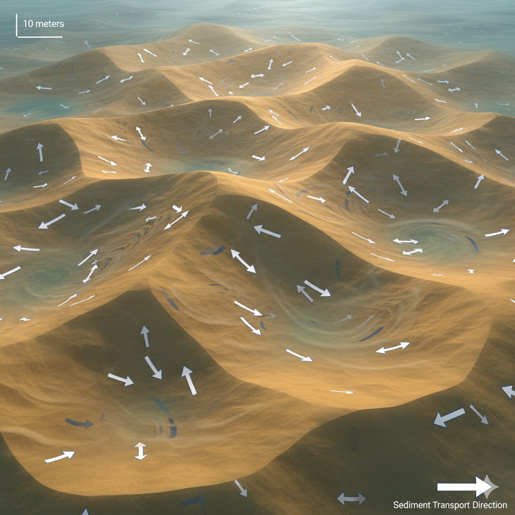
While some parts of the shelf are frozen in time, others are incredibly dynamic. On the shallow banks, where strong currents and storm waves affect the seabed, coarse-grained sands and gravels are in constant motion. This sediment transport creates massive underwater features called bedforms.
Sand waves on the Scotian Shelf can reach heights of up to 10 metres. Large fields of active sand bedforms exist on Browns Bank and Georges Bank. On Sable Island Bank, a "mobile layer" of sand under one metre thick moves on a storm-by-storm basis. This sediment mobility presents a challenge for pipeline stability. A buried pipeline could become exposed by scour, and an unburied one could be impacted by migrating sandwaves, creating unsupported spans. Understanding the direction and rate of this sediment movement is crucial for ensuring the long-term integrity of any structure placed on the seabed.
The Nearshore is a "Hostile Zone" of Hard Bedrock
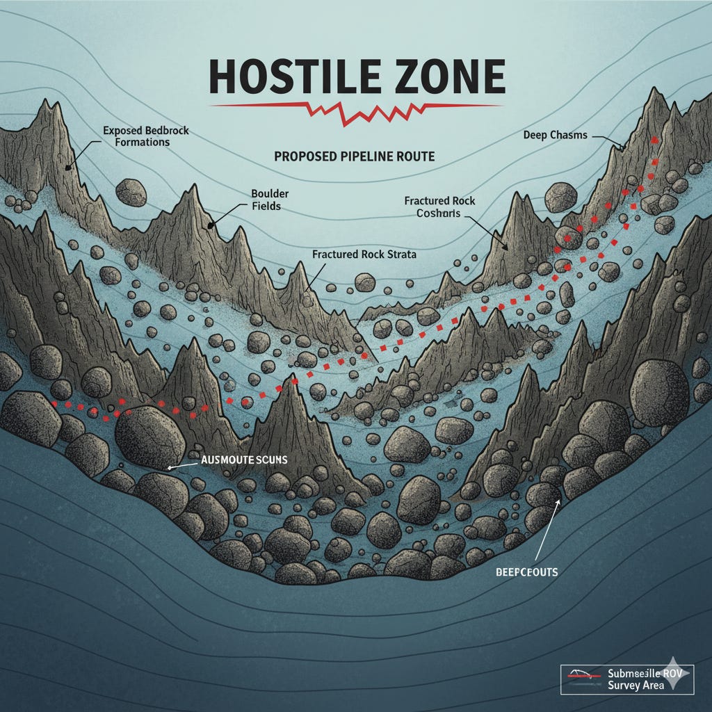
The transition from the deep ocean to the coast presents one of the most difficult challenges for a pipeline. The inner shelf, the area closest to shore, is a hostile zone for pipeline crossing. Unlike the soft mud basins or sandy banks, the inner shelf is often characterized by rugged, exposed bedrock. This bedrock is an offshore extension of Nova Scotia's hard metamorphic and crystalline rocks.
Multiple glaciations scraped away overlying sediments, exposing linear ridges and an irregular surface that reflects the bedrock's underlying structure of folds and faults. Glaciers also left behind their own difficult terrain, including fields of small, bouldery moraines. While there are some buried channels filled with softer sediment that offer potential routes, crossing the inner shelf means navigating a highly variable and often difficult terrain that presents the primary concern for routing a pipeline to shore.
The seafloor of the Scotian Shelf is a complex environment where ancient history and modern dynamic forces meet. The features left behind by glaciers thousands of years ago still define much of the landscape, while active processes like gas venting and sediment transport continue to shape it. Successfully building on this seabed requires a deep understanding of these hidden geological conditions. What other unseen challenges might engineers face when building in the deep ocean?
Sources:
King, E.L., Fader, G.B.J., Lynds, T., Hynes, S., and Miller, R.O. (2013). Blue Atlantic Pipeline Corridor Geologic Constraints, Scotian Shelf: Desktop Study (Open File 7147). Geological Survey of Canada. doi:10.4095/292608