

From Pencils to Satellites: 40 Years of Seeing the Battlefield
How did the navy go from manually plotting ships on paper to a global, real-time picture of the maritime world? The surprising evolution of the system that changed modern naval command.
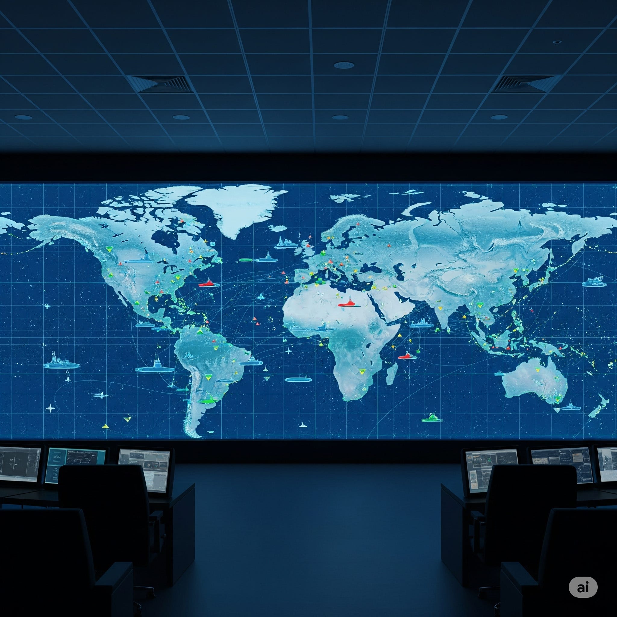
In any modern movie featuring a naval command center, the scene is always the same: a vast, glowing screen displays a map of the world, teeming with icons representing ships, submarines, and aircraft. Information is instant, awareness is total. This is the Common Operating Picture, the all-seeing eye of a modern military.
We see these high-tech displays and assume it’s always been this way. But for most of naval history, the fog of war was literal. A commander's picture of the battlefield was a murky, incomplete puzzle. And just a few decades ago, that puzzle was put together by hand.
In the Royal Canadian Navy, the "General Operation Plot" was not a computer, but a person. Armed with a pencil and a paper chart, they would manually plot the positions of friendly and enemy forces based on a slow trickle of radio messages, intelligence reports, and sightings.
This is the story of the incredible 40-year evolution of that plot, now known as the Recognized Maritime Picture (RMP). It’s a journey from pencils to satellites that has fundamentally transformed naval command and control, unpacking how technology has steadily peeled back the fog of war.
The Age of Pencils and Paper
Until the late 1980s, the RMP was a physical artifact. In the operations room of a Canadian warship, a plotter would receive disparate pieces of information—a LINK 11 tactical data message here, an Over the Horizon (OTH) Gold message there—and transcribe them onto a large plot. Ashore at headquarters, the same manual process was used to maintain the big picture.
The limitations were immense. The data was slow, often arriving over high-frequency radio teletype. The picture was always out of date, a reflection of where things were, not where they are. It was also highly susceptible to human error. For a commander trying to make critical decisions in a fast-moving environment, this system was a constant challenge.
The First Digital Leap
The late 1980s and early 1990s saw the first steps toward digitization. The Joint Operational Tactical System (JOTS) was introduced as a mission fit for HMCS Athabaskan during the Gulf War. For the first time, the plot was on a screen.
But this was digitization in its infancy. Using an analogy for today, it was like the earliest days of dial-up internet.
JOTS operated at slow "teletype speed" on high-frequency radio circuits and was severely limited in the number of tracks it could display. In the late nineties, it was replaced by the Joint Maritime Command Information System (JMCIS), which increased the track capacity but was still constrained by the same slow speeds. However, JMCIS was crucial for one reason: it was the Navy’s initial trial run for using satellite communications to share the RMP, a glimpse of the revolution to come.
The GCCS-M Revolution
The real turning point came between 1997 and 1999, with the arrival of the Global Command and Control System - Maritime (GCCS-M). This wasn't just an upgrade; it was a fundamental paradigm shift.
Instead of just digitizing the old, slow process, GCCS-M leveraged modern LAN/WAN networking and satellite communications to connect ships directly with shore-based operations centers. For the first time, everyone was looking at the same map in near real-time. This created a true Common Operating Picture (COP).
The system was revolutionary because it could automatically correlate and fuse contact information from multiple sources, creating a single, coherent picture out of a sea of data. Suddenly, the RMP wasn't just a historical record drawn in pencil; it was a living, breathing view of the entire maritime environment.
Modernization and the Future
The evolution didn't stop there. Over the next two decades, GCCS-M was continuously upgraded, improving network security, stability, and operator tools.
Another key piece of the puzzle fell into place in the 2000s with the mandatory international adoption of the Automatic Identification System (AIS), a transponder that broadcasts the identity and position of commercial vessels. The Canadian Navy developed a system called "AIS2Gold" to convert this public data into a format that could be fed directly into their classified GCCS-M network. This massively increased situational awareness, adding thousands of civilian vessels to the RMP and allowing military ships to stand out.
Today, the RCN is once again at a crossroads. The venerable GCCS-M system that powered this revolution is now nearing its end-of-life. The Navy is actively seeking its replacement, looking toward a future of open architecture systems that are more flexible and not tied to specific hardware.
A New Perspective
The 40-year journey of the Recognized Maritime Picture is more than a story of technological progress. It's a story about the relentless pursuit of clarity in the chaos of the maritime world. It traces the path from a single person with a pencil, struggling to make sense of the past, to a globally networked team sharing an instantaneous vision of the present.
The ability to see the battlefield clearly and share that vision across the entire fleet is one of the most powerful weapons a modern navy possesses. It’s a weapon forged not of steel, but of data.
What other everyday technologies do you think have completely revolutionized a specific industry or field?
If you found this story interesting, share it with someone who loves technology or history.
Follow "OnHansard" for more stories that decode the systems shaping our world.
Source: Maritime Engineering Journal, No. 112, Summer 2025